Where to locate remote area rescue tubes on Central Coast beaches
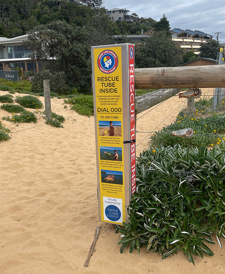
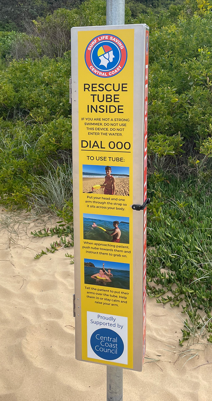
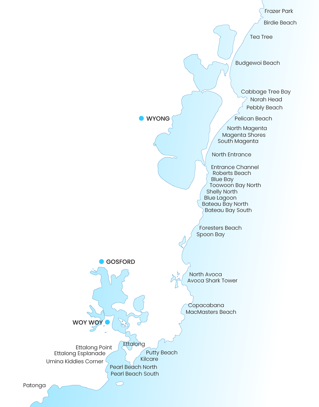
Our rescue tubes are located at the following unpatrolled locations. Here’ you’ll find full coordinates and images.
We can’t emphasise enough that if you are not a strong swimmer, these will not make you one. Please don’t enter the water if you’re not capable. But if you are, grabbing this before you go in could save two lives.
Easy to use instructions for use are on the tube box. Please help us look after them – Use the QR code inside to report a missing or damaged tube.
Remember – Always call 000 in an emergency situation.
Funded by Central Coast Council Community Grant Funding.
Remote area rescue tube location coordinates
| Tube # | Location | Long | Lat | Map Link |
|---|---|---|---|---|
| 1 | Frazer Park | -33.1874925 | 151.6229089 | Google Map Link |
| 2 | Birdie Beach | -33.2051050 | 151.6063974 | Google Map Link |
| 3 | Birdie Beach (Tea Tree) | -33.2072456 | 151.6032466 | Google Map Link |
| 4 | Budgewoi Beach | -33.2385512 | 151.5698850 | Google Map Link |
| 5 | Cabbage Tree Bay | -33.2789417 | 151.5679608 | Google Map Link |
| 6 | Norah Head Lighthouse | -33.2817300 | 151.5769777 | Google Map Link |
| 7 | Pebbly Beach/Soldiers Beach | -33.2894148 | 151.5695212 | Google Map Link |
| 8 | Pelican Beach | -33.2982919 | 151.5513740 | Google Map Link |
| 9 | North Magenta | -33.309570 | 151.531442 | Google Map Link |
| 10 | Magenta Shores | -33.3129383 | 151.5269398 | Google Map Link |
| 11 | South Magenta | -33.3202568 | 151.5174801 | Google Map Link |
| 12 | North Entrance/Channel North | -33.3395075 | 151.5038109 | Google Map Link |
| 13 | Entrance Channel (South) | -33.3454186 | 151.5019812 | Google Map Link |
| 14 | Roberts Beach | -33.3510589 | 151.5036958 | Google Map Link |
| 15 | Blue Bay | -33.3551329 | 151.5012164 | Google Map Link |
| 16 | Toowoon Bay (North Kim’s Retreat) | -33.3584929 | 151.5001583 | Google Map Link |
| 17 | North Shelly | -33.3668816 | 151.4936469 | Google Map Link |
| 18 | Blue Lagoon Holiday Park | -33.3788605 | 151.4858088 | Google Map Link |
| 19 | Bateau Bay (North) | -33.3824258 | 151.4850353 | Google Map Link |
| 20 | Bateau Bay (South) | -33.3846649 | 151.4825908 | Google Map Link |
| 21 | Forresters Beach | -33.4135103 | 151.4643515 | Google Map Link |
| 22 | Spoon Bay | -33.4198192 | 151.4585881 | Google Map Link |
| 23 | North Avoca (South) | -33.4622573 | 151.4367579 | Google Map Link |
| 24 | Avoca (Shark Tower) | -33.4654792 | 151.4349886 | Google Map Link |
| 25 | Copacabana (South) | -33.4924696 | 151.4293875 | Google Map Link |
| 26 | Macmasters (North) | -33.4962850 | 151.4261491 | Google Map Link |
| 27 | Putty Beach | -33.5287375 | 151.3737823 | Google Map Link |
| 28 | Killcare (North) | -33.5305444 | 151.3622166 | Google Map Link |
| 29 | Ettalong (Box on the Water Café) | -33.5155782 | 151.3350536 | Google Map Link |
| 30 | Ettalong Point | -33.5208475 | 151.3320418 | Google Map Link |
| 31 | Ettalong (The Esplanade) | -33.5236759 | 151.3298118 | Google Map Link |
| 32 | Kiddies Corner (OB Holiday Park) | -33.5297943 | 151.3122544 | Google Map Link |
| 33 | Pearl Beach (North) | -33.5376279 | 151.3112181 | Google Map Link |
| 34 | Pearl Beach (South) | -33.5443867 | 151.3072585 | Google Map Link |
| 35 | Patonga | -33.5543341 | 151.2692663 | Google Map Link |


